
Nachi Falls and Daimonzaka: Choose the Uphill Walk or Direct Bus
On this page
- Separate the three experiences on the hillside
- Choose the option that fits your day
- Choose your arrival stop from the walk you want
- Walk Daimonzaka as a place, not a shortcut
- Give the shrine and temple their own time
- See the waterfall from a comfortable viewpoint
- Fit the outing around Kii-Katsuura
- Two useful ways to shape a first visit
- Questions to settle before setting out
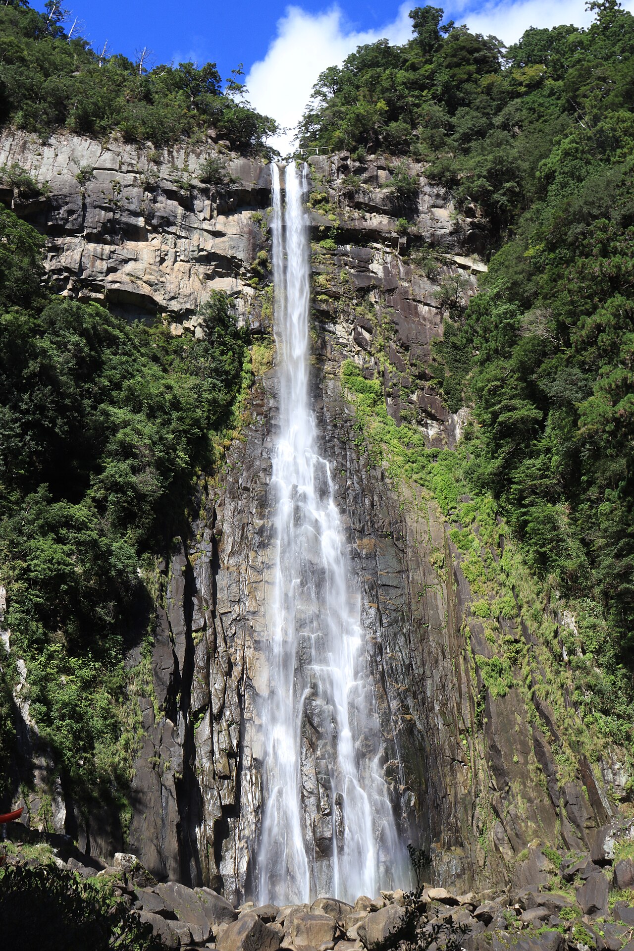
For a Nachi Falls day from Kii-Katsuura, decide whether the cedar-lined Daimonzaka climb belongs in your plan before choosing where to leave the bus. An uphill pilgrimage approach, the shrine and temple precincts, and the waterfall can form one satisfying outing. Travellers wanting fewer climbs can use a different stop and build a shorter visit around their main interest. The important choice is the shape of the walking route, not simply getting to a famous photograph.
Separate the three experiences on the hillside
The Nachisan area brings together Kumano Nachi Taisha, the Buddhist Seiganto-ji temple and Nachi Falls. They share a remarkable setting, but they are distinct places with their own visitor spaces. Understanding that relationship helps you build a route that includes time to worship, read the interpretation, enjoy the landscape or take photographs without rushing between pins on a map.
Daimonzaka adds a historic stone-paved approach through tall trees. The Tanabe City Kumano Tourism Bureau describes the actual stone staircase as roughly six hundred metres with 267 steps. That is the famous forest section, not the entire distance from a transport stop through every shrine, temple and waterfall viewpoint. Keep the climb and the wider Nachisan circuit as related but separate parts of your plan.
Nachi Falls itself is a sacred focus of the landscape. The view beside the temple pagoda and the approach to Hiro Shrine below offer different perspectives. A photograph containing both the pagoda and waterfall does not mean they are one building or one entrance. Choose the places you want to experience, then use the visitor map to connect them in a manageable sequence.
Choose the option that fits your day
| Your situation | Useful choice | Check before committing |
|---|---|---|
| Want the cedar-lined approach | Start at Daimonzaka | Include the wider hillside circuit |
| Prefer fewer climbs | Use a stop near the main interest | Confirm the precise remaining steps |
| Driving to the lower area | Plan parking and return together | Check the actual bus back to your car |
Choose your arrival stop from the walk you want
Local tourism information describes buses from Kii-Katsuura and Nachi stations serving the Daimonzaka area, the waterfall entrance and Nachisan. Those stops support different outings. On the Nachisan Line, Daimon-zaka Slope Chushajo (Parking Lot) and Daimon-zaka Slope serve the historic approach. Nachi-no-Taki-mae serves the waterfall area, while the Nachisan terminus suits the upper shrine-and-temple visit. These are alternative starting points, with walking still required from each. If you want the stone-paved forest approach, get off for Daimonzaka using the stop indicated by the current route information. If the shrine and temple are the priority, a service farther uphill may fit better.
Read the timetable in both directions before boarding. Keep the exact Japanese stop names, the direction of travel and the useful return departures saved on your phone. A return from the waterfall area can save retracing the entire climb, but only when the service and your walking route actually match. The existence of several stops does not make every connection equally frequent or equally convenient.
Choose the return rail connection as part of the same plan if you are leaving Kii-Katsuura that day. Include the bus journey, walking to the station, collecting luggage and finding the correct platform. A sightseeing route can look short on a map while still requiring generous time for steps, pauses and transfers. Protect the onward connection by keeping one part of the sightseeing circuit flexible.
For drivers, parking and walking should also be planned together. Wakayama's official walking itinerary describes using Daimonzaka parking and returning by bus from the waterfall area. Check that arrangement against your visit date and the actual bus service. If you prefer to return on foot, recognise that it changes the day's walking effort rather than being an incidental final step.
Rachel Roams records the Nachi shrine and waterfall landscape in an October 2016 post. View original
Walk Daimonzaka as a place, not a shortcut
The appeal of Daimonzaka is the experience of climbing through the forest on the old stone way. Give yourself permission to slow down and look around. Stone steps, roots, shade and moisture affect your pace, so a map's distance alone is a poor measure of how the approach will feel. Start with footwear that allows you to place your feet securely.
If your group has different walking speeds, agree on a meeting place before the climb. Keep people together where the route is unfamiliar, and take photographs from a stopping position rather than while stepping backward. The forest can be visually absorbing; a brief pause allows you to appreciate the trunks and the stonework without losing attention to your footing.
Daimonzaka is one section of the wider Kumano Kodo landscape. Completing this short approach does not require you to be undertaking a multiday pilgrimage, and it should not be confused with the demands of a much longer trail. Enjoy it for the particular experience it offers. If you want to continue beyond the usual visitor circuit, plan that extension with appropriate trail information and daylight.
At the end of the forest section, reorient yourself for the shrine and temple rather than assuming the entire climb has finished. The official Wakayama itinerary links Daimonzaka with the religious precincts and then the waterfall. Follow the signed open routes and take a rest when needed. The best route is the one that leaves enough energy for the places you came to see.
Give the shrine and temple their own time
Kumano Nachi Taisha and Seiganto-ji deserve more than a quick stop on the way to the pagoda photograph. Notice the different religious spaces, follow the local signs, and keep passageways available to other visitors and worshippers. If you want to enter a particular building, check its own opening arrangements rather than relying on general access to the surrounding precinct.
Choose a sequence that makes sense on arrival. You might begin with the main shrine or temple interest, then move toward a scenic viewpoint once everyone has rested. A fixed photograph can wait while you orient yourself. This approach is especially useful when a group includes someone interested in the history and another person more interested in the landscape.
Avoid treating all the hillside steps as interchangeable. A descent toward the waterfall changes where you will finish, which may also change your useful return stop. Before leaving the upper precinct, glance at the route map and confirm the next destination. Having a clear direction makes the descent easier to enjoy and reduces the chance of climbing back unnecessarily for a missed connection.
Slice of Japan provides a 2026 itinerary with separate chapters for Kumano Nachi Taisha, Nachi Falls and Daimonzaka. View original
See the waterfall from a comfortable viewpoint
The classic pagoda-and-waterfall composition places human architecture against the much larger forest landscape. Look first at the scene itself, then decide how much of it you want in a photograph. The waterfall can be compelling as a distant vertical line or as a closer study of water and rock. Different views offer different experiences rather than a single correct image.
When you descend toward Hiro Shrine, follow the visitor route and current instructions. The approach involves steps, so include the return climb from the lower area when judging your energy. If you want a particular paid viewpoint or facility, confirm its entry arrangements separately. Choose the viewing area you want, then check its entrance and opening arrangements.
Use photographs and videos to understand the setting without assuming they show today's conditions. Water flow, weather, light and maintenance work can change the appearance of a view. A creator's dawn walk also reflects that creator's transport and timing. You can enjoy the same landscape in ordinary daytime without reproducing a predawn itinerary or an exact camera position.
Ambient Exploration describes a dawn circuit from the upper precinct to the waterfall filmed in July 2025. View original
Fit the outing around Kii-Katsuura
A meal in Kii-Katsuura before or after the hillside visit can give the day a pleasant contrast. Decide which part of the day is fixed: the bus, a restaurant booking, your accommodation check-in or the onward train. Keep the other elements flexible around that commitment. A relaxing meal is easier to enjoy when you already know how you will return from Nachisan.
If your accommodation holds your luggage, include the collection in your station plan. Carry only what you need for the steps and weather. The hillside route is more comfortable with hands free and a manageable bag than with belongings intended for a full travel day. Ask your accommodation about its actual luggage arrangements rather than assuming a service is available everywhere.
An overnight stay can offer a less compressed schedule, but it does not remove the need to check local transport. Early and late services may differ from the middle of the day. If you have a specific photography time in mind, arrange the journey before setting the alarm. The landscape is worth seeing when your travel plan supports the experience comfortably.
Two useful ways to shape a first visit
For a walking-focused visit, take the bus to the appropriate Daimonzaka stop, climb the forest approach, visit the shrine and temple, then continue toward the waterfall and a suitable return stop. This creates a coherent progression from the old path to the religious precincts and the water landscape. Use the official walking itinerary as a route framework and adapt it to the conditions and pace of your group.
For a visit with fewer climbs, use a bus stop closer to the main place you want to see and keep the circuit smaller. This does not make the hillside entirely step-free, so ask about the exact access you need. You can still enjoy a meaningful visit without adding Daimonzaka simply because it appears in a popular itinerary. Choose the route from your interests and mobility first.
Whichever version you choose, finish with a clear return rather than an improvised search for transport. Save the bus stop location before putting away the map, allow time to walk there, and keep a later alternative where the timetable provides one. A complete Nachi day is a well-paced connection between landscape, religious places and transport, with room to appreciate each part.
HOWELL introduces Seiganto-ji and the waterfall together in an April 2025 short video. View original
Questions to settle before setting out
Must I climb Daimonzaka to see Nachi Falls?
No. Local bus information lists stops for different parts of the Nachisan area. Daimonzaka is an optional historic approach that adds an uphill forest walk. Choose the stop that supports the experience you want and check the remaining steps on the exact route.
Is the stone staircase the whole walk?
No. The frequently cited staircase measurement describes the historic forest section. Connecting the bus stop, shrine, temple, viewpoints and waterfall adds more walking. Plan the entire circuit and the return journey together.
Can I return from a different stop?
The local bus network serves several points on the hillside, and official itineraries use that flexibility. Match the current departures to your route and destination. Save the specific stop name and direction before starting the walk.
 ぶらり6時間半どこへ?世界も注目「日本一長い路線バス」世界遺産の絶景“天空の郷”【Jの追跡】【スーパーJチャンネル】(2026年5月3日)
 “日本のスイス”上高地に観光客殺到 駐車場は夜明け前に満車 バス停に早朝100人【もっと知りたい!】【グッド!モーニング】(2026年10月11日)
